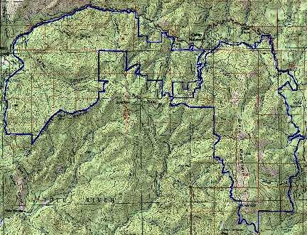
Size: The Black Mountain roadless area is approximately 15,041 acres according to Forest service RARE II acres, while the Slate Mountain roadless area is approximately 5,373 acres in size for a total of 20,414 acres.
Land management agency: Sequoia National Forest and Giant Sequoia National Monument
RARE II names: Black Mountain Roadless Area and the Slate Mountain Roadless Area.
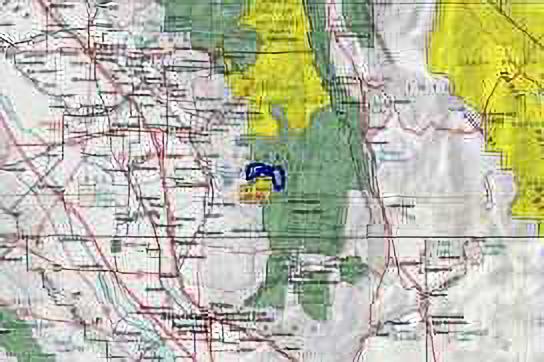
Location: Both of these areas are located within Tulare County and the Sequoia National Monument and National Forest. The Black Mountain Roadless Area lies just east of Porterville, sandwiched between Highway 190 on the north and the Tule River Indian Reservation on the south. The Slate Mountain Roadless Area straddles the summit of the Western Divide about 40 airline miles east of Porterville California, at the higher elevations to the east of the Black Mountain Area. The two areas are separated by a gravel forest road.
This potential wilderness area consists of two different roadless areas, the Black Mountain area and the Slate Mountain area. A narrow gravel forest road separates the two areas, providing hiking access to both areas from the same roadheads. Both areas would provide outstanding opportunities for recreation and protection of valuable natural features. Deer, countless bird species, and numerous species of mammals, including Pacific fisher and spotted owl, are found in the area during the summer. Many of the streams support healthy populations of trout providing excellent recreation opportunities for fishermen.
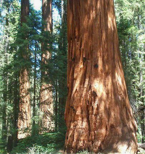
Most of the lower elevations of the Black Mountain portion are covered by thick high chaparral, a habitat which is unfortunately rarely represented in the National Wilderness System. Between the elevations of 5,000 and 6,000 feet, conifer forest replaces the nearly impenetrable chaparral. It is here that the Giant Sequoia trees lie scattered along the north facing slopes of the forest. The Belknap, McIntyre, Wheel Meadow, Red Hill, and the Black Mountain Groves lie entirely or partially within the area. The Black Mountain Grove is one of the finest groves throughout the range of the Big Trees.
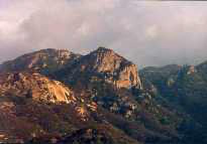
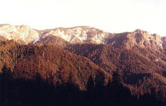
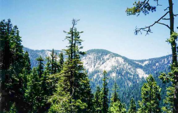
The rugged slopes of Slate Mountain dominate the view into the potential wilderness from most directions. Elevations range from about 5,000 feet to 9,302 feet at the summit of Slate Mountain. The entire area is covered with conifer forests. Large open wet meadows are interspersed throughout along the watercourses. The open sunny meadows and many open but drier areas are covered with wildflowers until late in the summer.
Abstract
The proposed Wilderness includes two units - derived from the Black Mountain and Slate Mountain Roadless Areas. These areas are adjacent to each other, separated by one gravel road providing hiking access to both areas from the same roadheads In combination, the proposed Wilderness features an elevation change from oak-woodland foothills to over 9,000 feet on Slate Mountain. Both of these potential Wilderness areas would provide outstanding opportunities for recreation and protection of valuable natural features.
Black Mountain Area
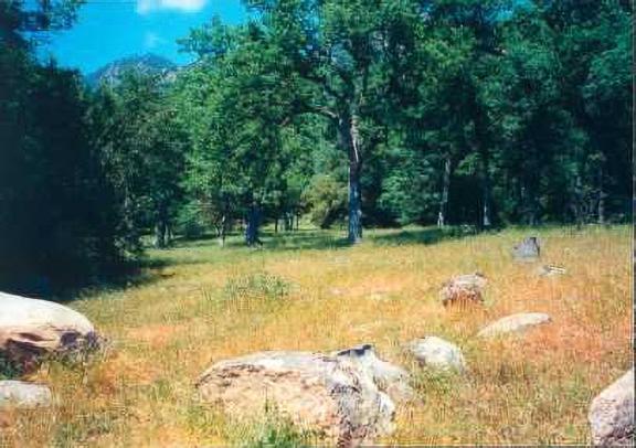
Most of the lower elevations of the Black Mountain portion of the proposed Wilderness are covered by thick high chaparral, a habitat which is unfortunately rarely represented in the National Wilderness System. Between 5,000 and 6,000 feet, the mixed conifer forest includes Giant Sequoia groves. The Black Mountain Grove is one of the finest groves throughout the range of the Big Trees.
Slate Mountain Area
The rugged slopes of Slate Mountain dominate the view into this unit of the proposed Wilderness from most directions. Five Giant Sequoia groves lie entirely or partially within the area. The oldest trees are over 3,000 years old. Rare birds such as the California spotted owl and declining furbearers like the Pacific Fisher are found in the area. The proposed Slate Mountain Wilderness would have easy access from existing roads and would provide opportunities for recreation and for protection of valuable natural resources.
Narrative
Black Mountain Area
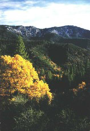
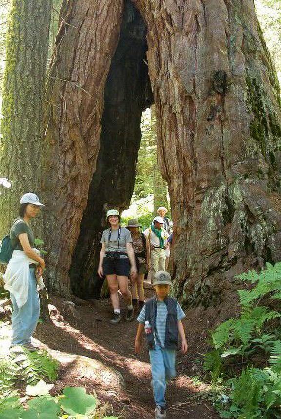
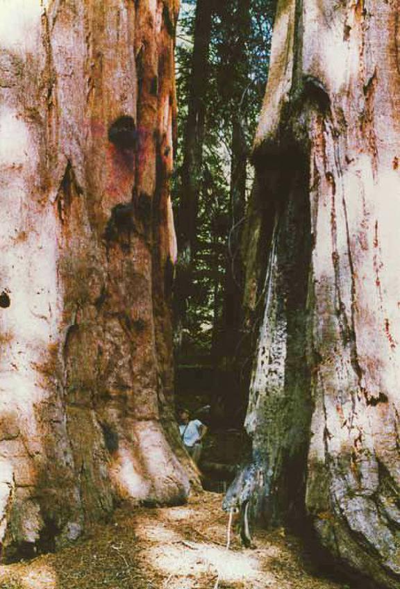
Most of the lower elevations of the Black Mountain portion of the proposed Wilderness are covered by thick high brush, almost impossible to pass through on foot. Between 5,000 and 6,000 feet conifer forest replaces the nearly impenetrable chaparral. It is here that the Giant Sequoia trees lie scattered along the north facing slopes of the forest. Some of the monarchs in the grove are among the largest found anywhere in the Sierra. Some are taller than the Capitol Dome in Washington DC and more than 3,000 years old. Some of the largest trees are found in stands that rival the groupings in Sequoia National Park. It is a humbling experience to walk among these trees that were giants at the birth of Christ 2,000 years ago and over 30 feet in diameter at the base. There is no other place in the entire world like the southern Sierra Nevada where this kind of experience can be enjoyed. The Black Mountain Grove is one of the finest groves throughout the range of the Big Trees. The monarch sequoias would be the most important feature of the Wilderness and would be easily accessible from the existing road network outside of the proposed Wilderness.
Excellent habitat for the Pacific fisher and the California spotted owl is found within the proposed Wilderness. Both of these declining species need old growth forest with a closed or nearly closed canopy. Populations of these species have been declining at an alarming rate over the past several years and the scientific community has recommended that their habitat be carefully protected. Wilderness designation of the Roadless Area would be the most effective way to accomplish that goal. Deer herds use the upper elevations for summer range and the brushy lower areas during the winter. Many species of songbirds are also found in the area.
Part of the Black Mountain Grove is outside the proposed Wilderness area because the Forest Service conducted logging operations there during the 1980s. Clear cutting was the main technique used, leaving only the giant monarch sequoias in the clear cuts. Today those clear cuts are primarily covered by thick, nearly impenetrable brush, over a person's head. There is very little regeneration of trees to replace those that were cut. A small part of the grove is in the adjacent Tule River Indian Reservation, which is again excluded from the proposed Wilderness. However. much of the grove is still in a natural condition unaffected by the roading and logging that went on in the 1980s and would benefit from the strong protection provided by the Wilderness Act.
Near the western boundary of Sequoia National Forest, elevations drop below 3,000 feet. Solo Peak at about 7,100 feet, is the highest point in this unit, and lies along the ridge separating the National Forest from the Indian Reservation. Highway 190 follows the north bank of the Tule River and marks the northern limit of the proposed Wilderness. Monument visitors driving up Highway 190 from Springville to Camp Nelson can look directly into the proposed Wilderness as it rises directly from the Tule River southward up a rugged escarpment to the crest of the watershed divide. The Tule River can be reached by scrambling down the steep slope from nearby Highway 190, but there are no trails. Access to the roaded portion of the Black Mountain Giant Sequoia Grove is along unpaved logging roads that start near Roger's Camp above Camp Nelson.
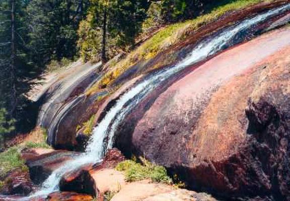
In the Black Mountain area, a winter snow pack accumulates at higher elevations to a depth of several feet and slowly melts during the spring to feed the numerous small streams that tumble and cascade northward down to the Tule River. Winter storms dump huge amounts of precipitation, mostly in the form of snow, along the western slopes of the southern Sierra. Spring runoff is collected downstream on the Tule River at Lake Success where it is stored for summer use on the farms of the San Joaquin Valley. Protection of the watershed to assure high water quality would be one of the benefits of designating the area as Wilderness.
Slate Mountain Area
The Slate Mountain Roadless Area straddles the summit of the Western Divide about 40 airline miles east of Porterville California, just to the east of the Black Mountain unit of the proposed Wilderness area. From Quaking Aspen southward the Western Divide Highway skirts along the eastern boundary of the proposed Wilderness area. The unpaved but high standard Windy Gap Road provides access from the south and west. Part of the California Riding and Hiking Trail runs through the area from north to south passing over the summit of Slate Mountain. Side branching trails connect with campgrounds and trailheads along the main roads.
From about 5,000 feet at Camp Nelson on the northwest, elevations climb to the summit of Slate Mountain at 9,302 feet. The rugged slopes of Slate Mountain dominate the view into the proposed Wilderness from most directions. The entire area is covered with conifer forests. At lower elevations Jeffrey pine, incense cedar, and black oak predominate and as elevation increases white fir and then red fir predominate. At the summit of Slate Mountain conifer forest begins to yield to alpine conditions. At these elevations snow lingers until late in the summer and a winter snow pack accumulates to a depth of several feet. The heavy winter precipitation provides ample water for perennial creeks that drain both west to the Tule River and east to the Kern River. Large open wet meadows are interspersed throughout the conifer forest along the watercourses. Some of the meadows provide headwaters for streams. The open sunny meadows and many open but drier areas are covered with wildflowers until late in the summer. Microclimates range from hot and dry to wet and cool providing the conditions for many unusual plant communities.
Perhaps the most visually stimulating features of the proposed Wilderness are the Giant Sequoia Groves. The Belknap, McIntyre, Wheel Meadow, Red Hill, and Black Mountain Groves lie entirely or partially within the area. Some the old monarchs within these groves are among the finest found anywhere.
During the summer deer, countless bird species, and numerous species of mammals are found in the area. Some of these species migrate in the winter months. Many of the streams support healthy populations of trout providing excellent recreation opportunities for fishermen. Among the rarer species are the California spotted owl and the Pacific fisher. Populations of spotted owls have been declining at an alarming rate in the last few years making it imperative to protect as much habitat as possible for this imperiled species. An isolated population of Pacific fisher is found in the southern Sierra south of Yosemite National Park. This fisher population has been recognized as imperiled. They require old growth forest with a canopy as closed as possible. These conditions prevail in the Slate Mountain Roadless Area.
The Slate Mountain portion of the proposed Wilderness would have easy access from the roads that surround it, providing an excellent opportunity for day use recreation as well as more extended stays. Hiking and horseback trails are well distributed. The wide variety of ecosystems would be best protected with Wilderness designation. There is also an excellent opportunity to protect some of the Giant Sequoia Groves in a pristine condition within the proposed Wilderness.
- Log in to post comments